This temple is located in the Bhojpur village in the Indian state of Madhya Pradesh. The temple construction was started in the 11th century, during the reign of Paramara king Bhoja. The construction was abandoned for unknown reasons, with the architectural plans engraved on the surrounding rocks.
It appears that the construction work stopped abruptly due to unknown reasons. Historians speculate that the abandonment may have been triggered by a sudden natural disaster, lack of resources or a war. To the north and east of the temple, there are several quarry sites, where unfinished architectural fragments in various stages of carving were discovered.
The temple lies on a platform which is 35m long, 25m wide and 4m high. A huge limestone lingam is installed on the platform. The total height of the lingam, including the platform is over 12m. The doorway to the sanctum is 10m high. The wall at the entrance features sculptures of apsaras, ganas and other goddesses. The temple walls are made of large sandstone blocks, without windows. The northern, southern and eastern walls of the temple, features three balconies, purely for ornamental purpose. They cannot be approached from either inside or outside of the temple, because they are located high up on the walls, which provided a drainage outlet for the liquid used to bathe the lingam.
In the year 1951, the site was handed over to the Archaeological Survey of India (ASI) for conservation. Under the supervision of ASI, the restoration of the damaged temple was taken place and the temple has been designated as a Monument of National Importance.
Bhojeshwar TempleBhojeshwar TempleBhojeshwar Temple – Sculptures on the wallBhojeshwar Temple – Sculptures on the wallBhojeshwar Temple – carved drainage outletAround the templeThe huge linga installed on the platformThe roof of the templeMore sculptures from the wallsMore sculptures from the wallsMore sculptures from the wallsOne of the ornamental balconies of the temple
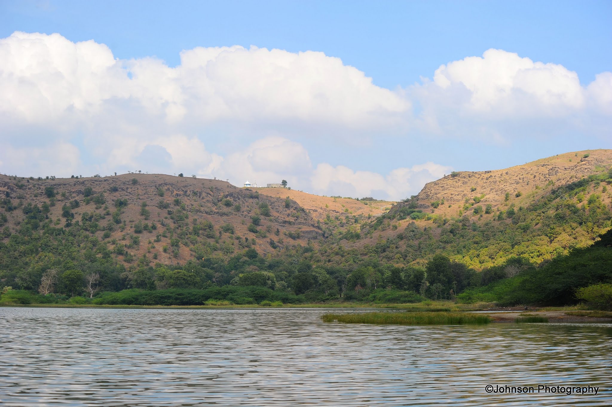
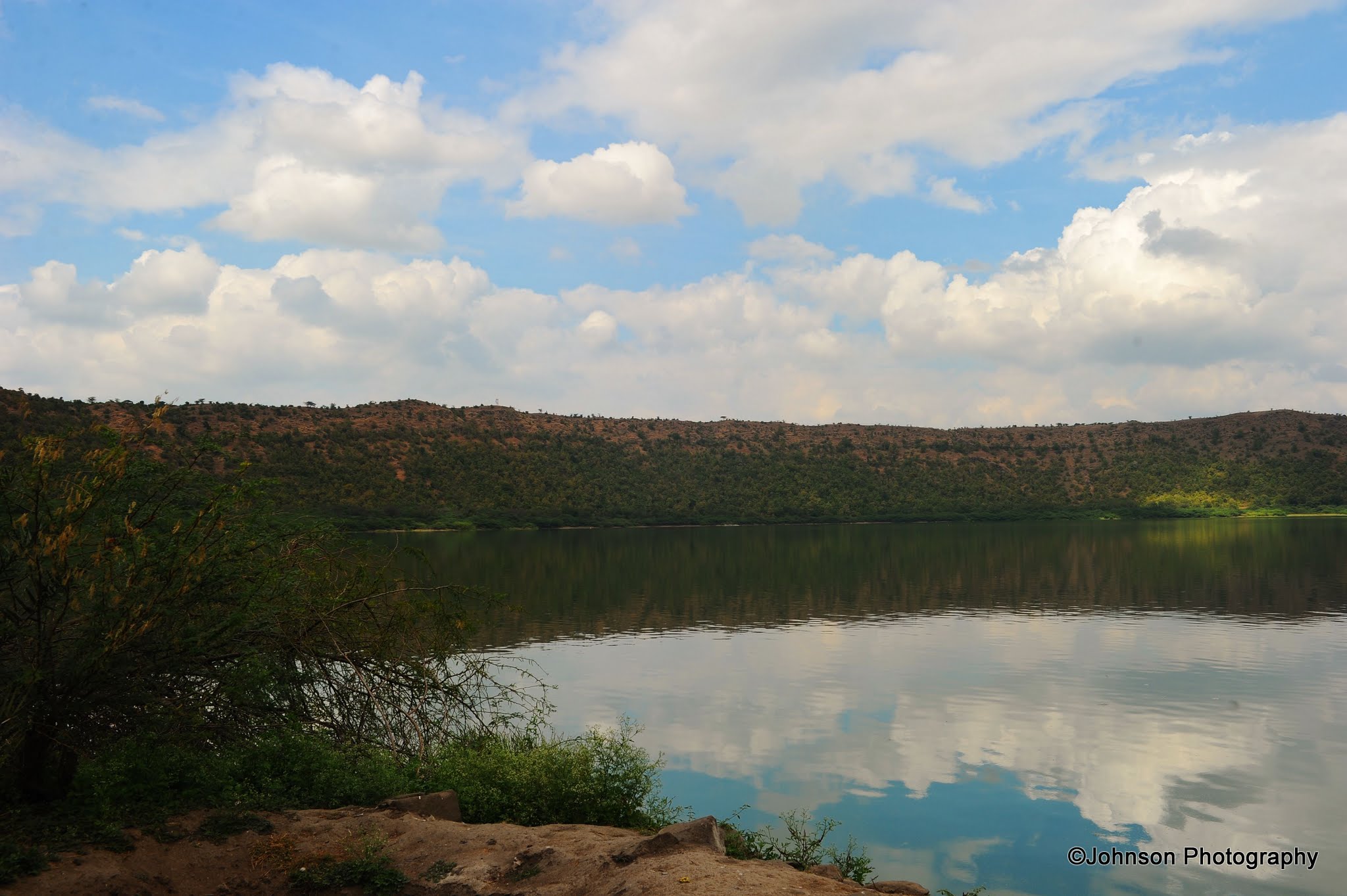
Lonar Lake is a saline soda lake located at Lonar in the Buldhana district of Indian state of Maharashtra. It was created by meteor impact during the Pleistocene epoch and is the only known hyper velocity impact crater in basaltic rock anywhere on earth. Researchers believe that meteor of about 60 meter diameter and weighing a million tones in the form of a stone had struck the earth at 20km/sec high velocity creating tremendous energy & heat and a cloud of molten ash and dust. It resulted in the destruction of neighbouring flora and fauna. The explosion was equivalent to that of a 6 megaton bomb. The meteor is believed to have been buried 600 meter below the crater level. The impacting crater struck at an acute angle from the northern side and thus the walls of crater slope gently over here. Rest everywhere, an uniform slope of 26 degrees is present.
The lake has a mean diameter of 1.2 kilometeres and is about 137 meters below the crater rim. The crater rim is about 1.8 kilometeres in diameter. The crater’s age is usually estimated to be 52,000 ± 6000 years.
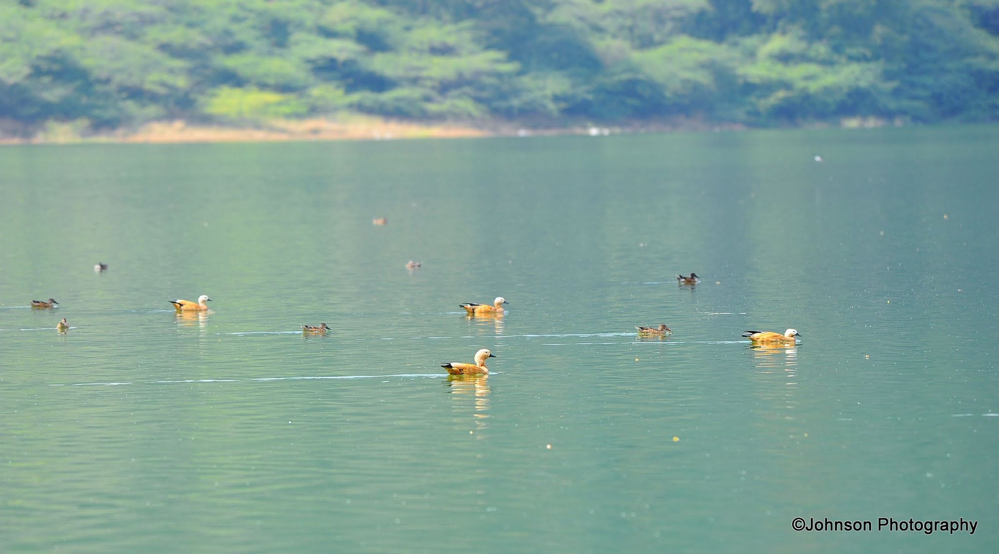
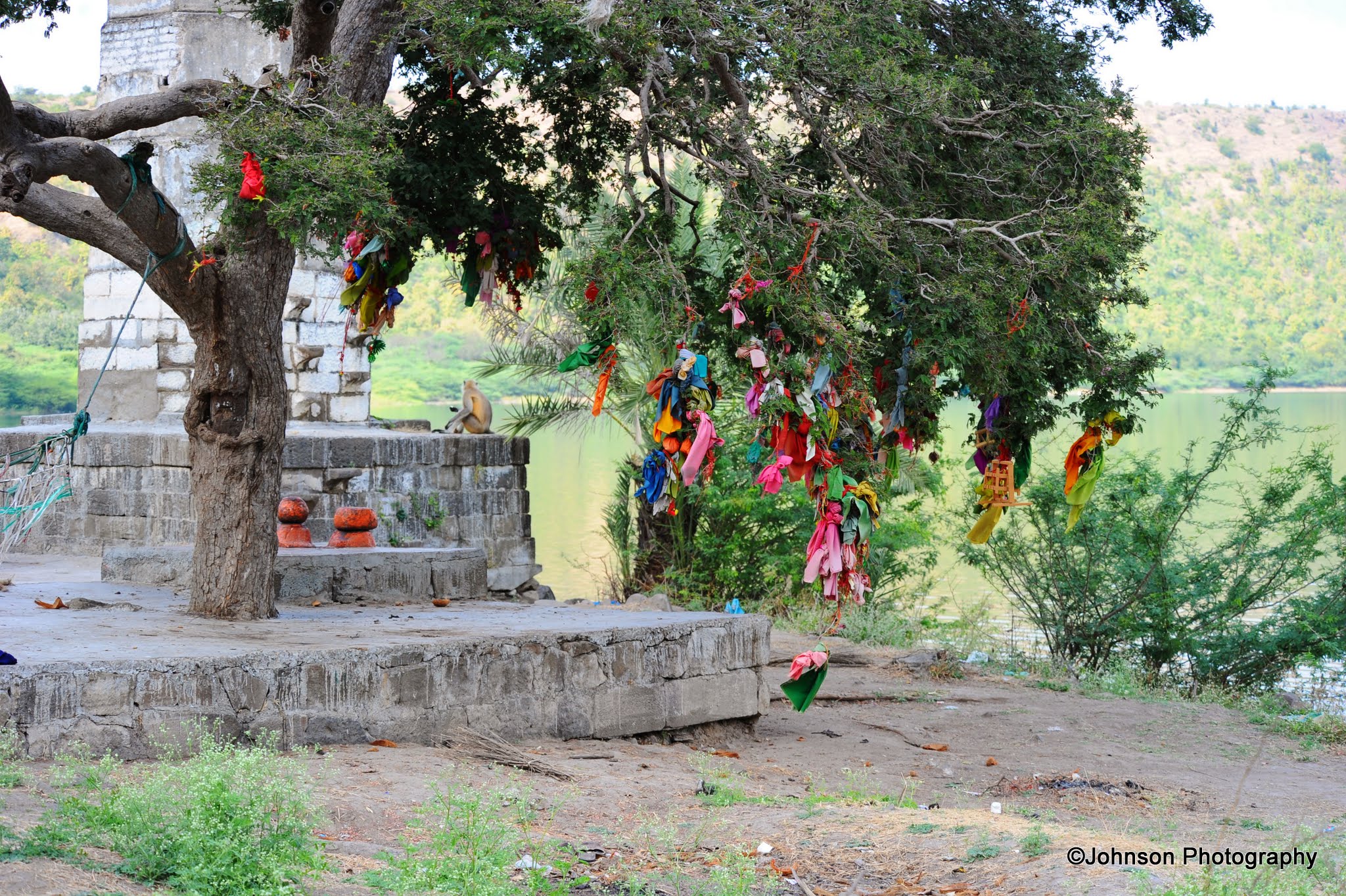
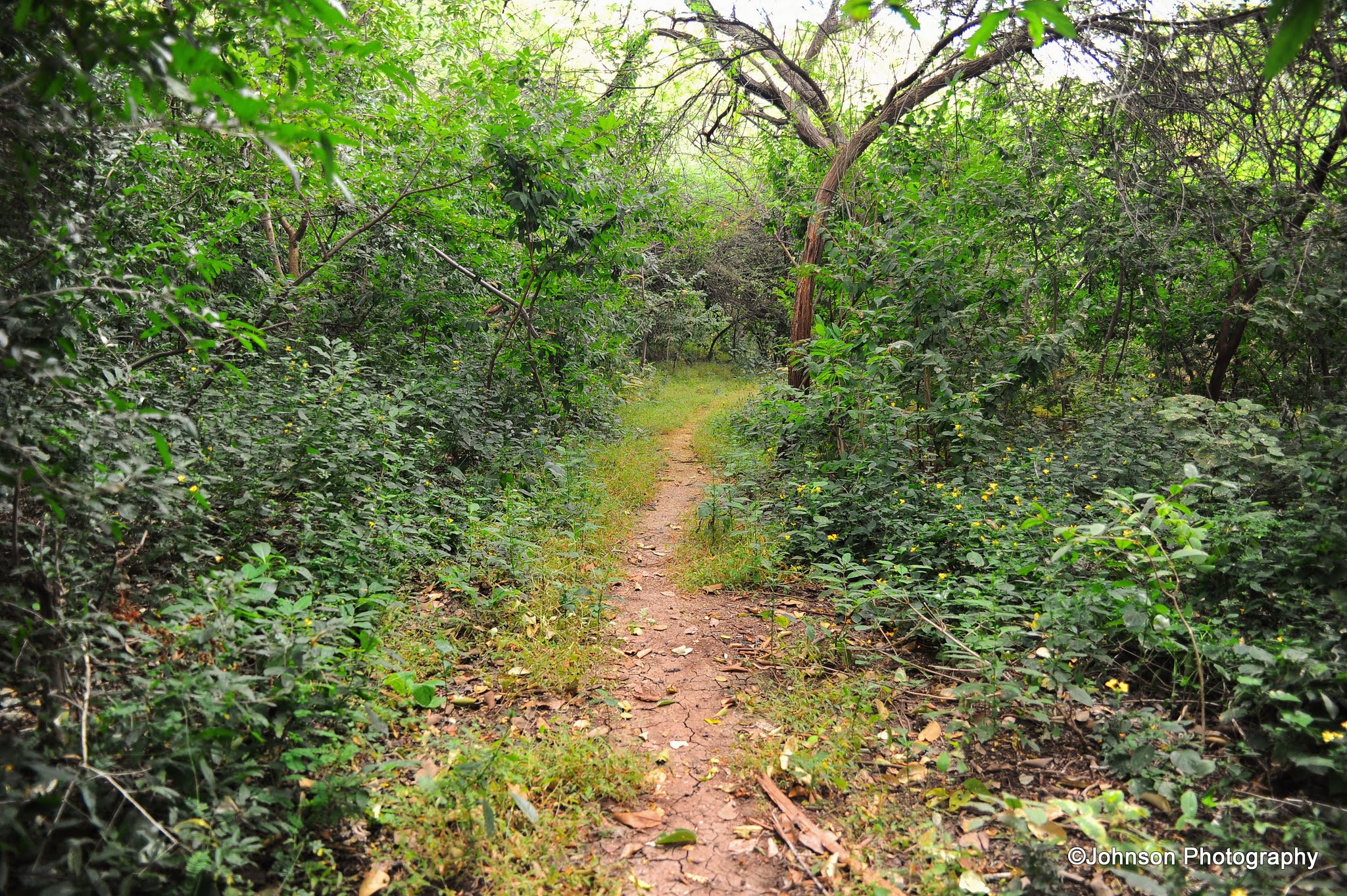
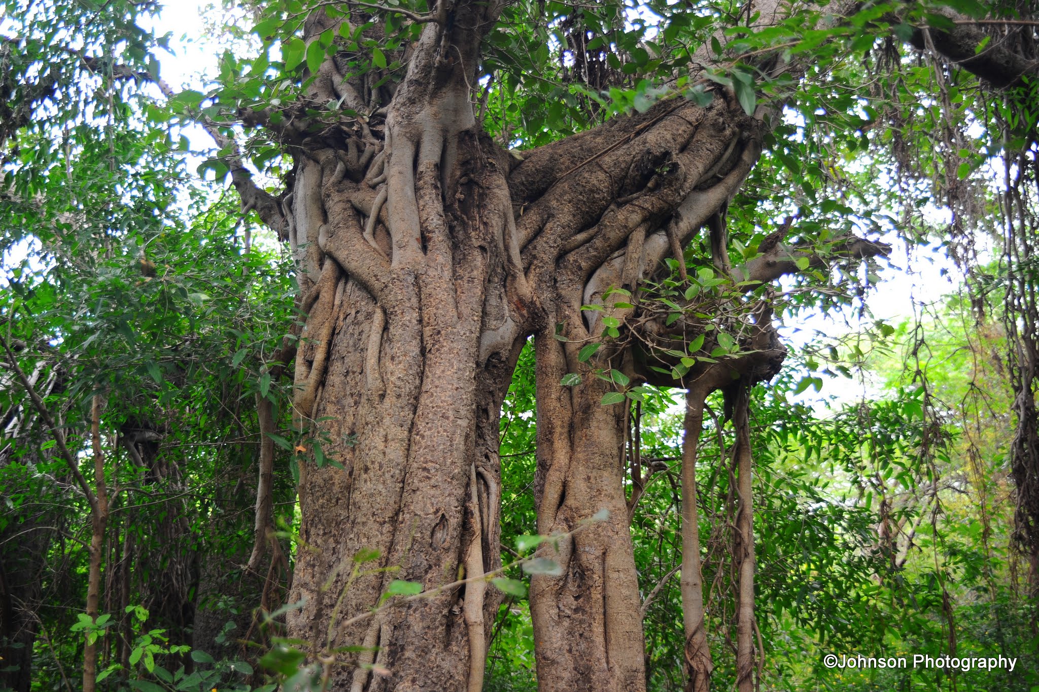
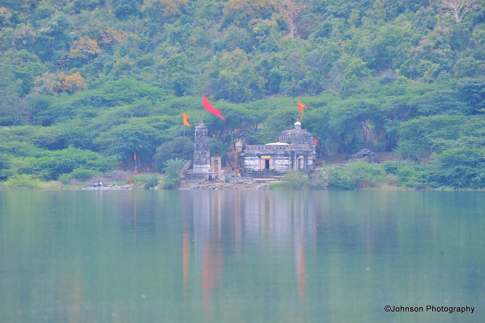
The forest department have planted different species of plants inside the rim of the lake, which gives an exotic experience to the visitors. It is home to many birds and animals. Near the crater around the margin of the lake, there are a number of temples which are mostly in ruins. These temples were believed to have been built during the 12th and 13th centuries. Some of these temples were constructed during the Yadava period.
View of the Lonar crater lake from near the MTDC Guest HouseThe trail around the lake through the vegetationAnother view of the lakeThe trail around the lake through the vegetationA red-wattled lapwig in the lakeBlack-winged stilts in the lakeDucks inside the lakeBlack-winged stilts in the lakeI encountered this bulbul during my trail around the lakeRuins of the temple around the lakeMore ruinsAround the lakeRuins of the temple around the lakeAnther view of the lakeRuins of the temple around the lakeThe trail around the lake through the vegetationTrees around the lakeRuins of the temple around the lakeRuins of the temple around the lakeRuins of the temple around the lakeRuins of the temple around the lakeRuins of the temple around the lakeMore ruins
Gomukh Temple needs a special mention due to the perennial stream which emerges from here; the source of which is yet to be identified. The pilgrims, visiting the temple takes a bath in this water.
Steps towards the Gomukh templeThe perennial stream inside the Gomukh templeGomukh templeMTDC Guest HouseMTDC Guest House
The Lonar Lake was mentioned in many ancient scriptures such as Skanda Purana, the Padma Purana and the Ain-i-Akbari. The first European to visit the lake was British officer, J E Alexander in 1823.
Ambar Lake
Not far from the Lonar lake is a small lake called Ambar Lake which is believed to be caused by a splinter of the meteor that created the Lonar crater lake.
Ambar Lake
Daitya Sudan Temple
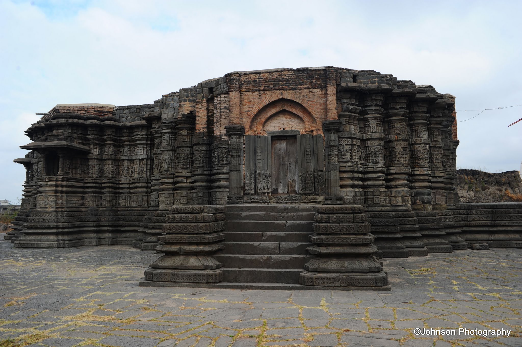
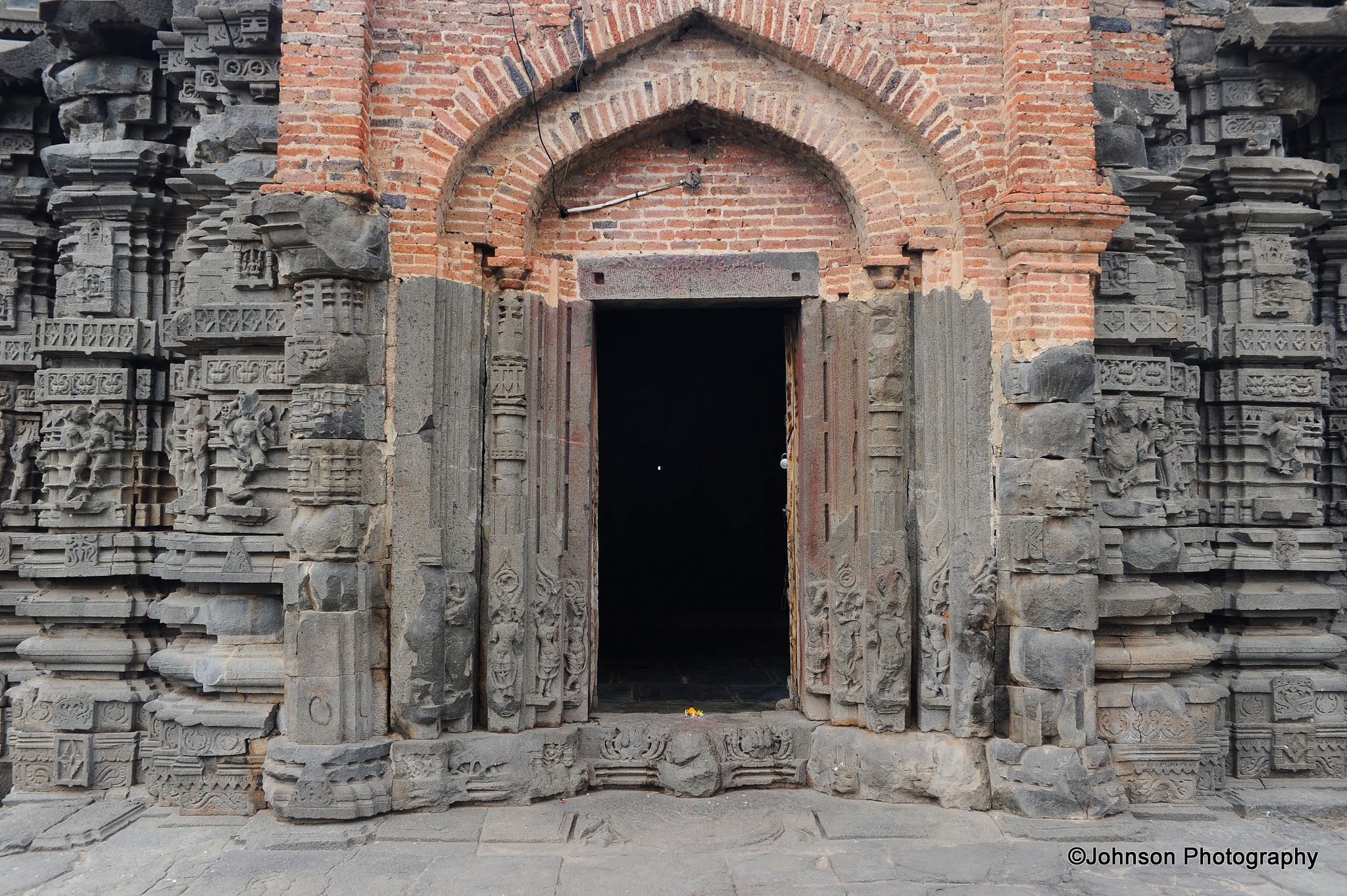
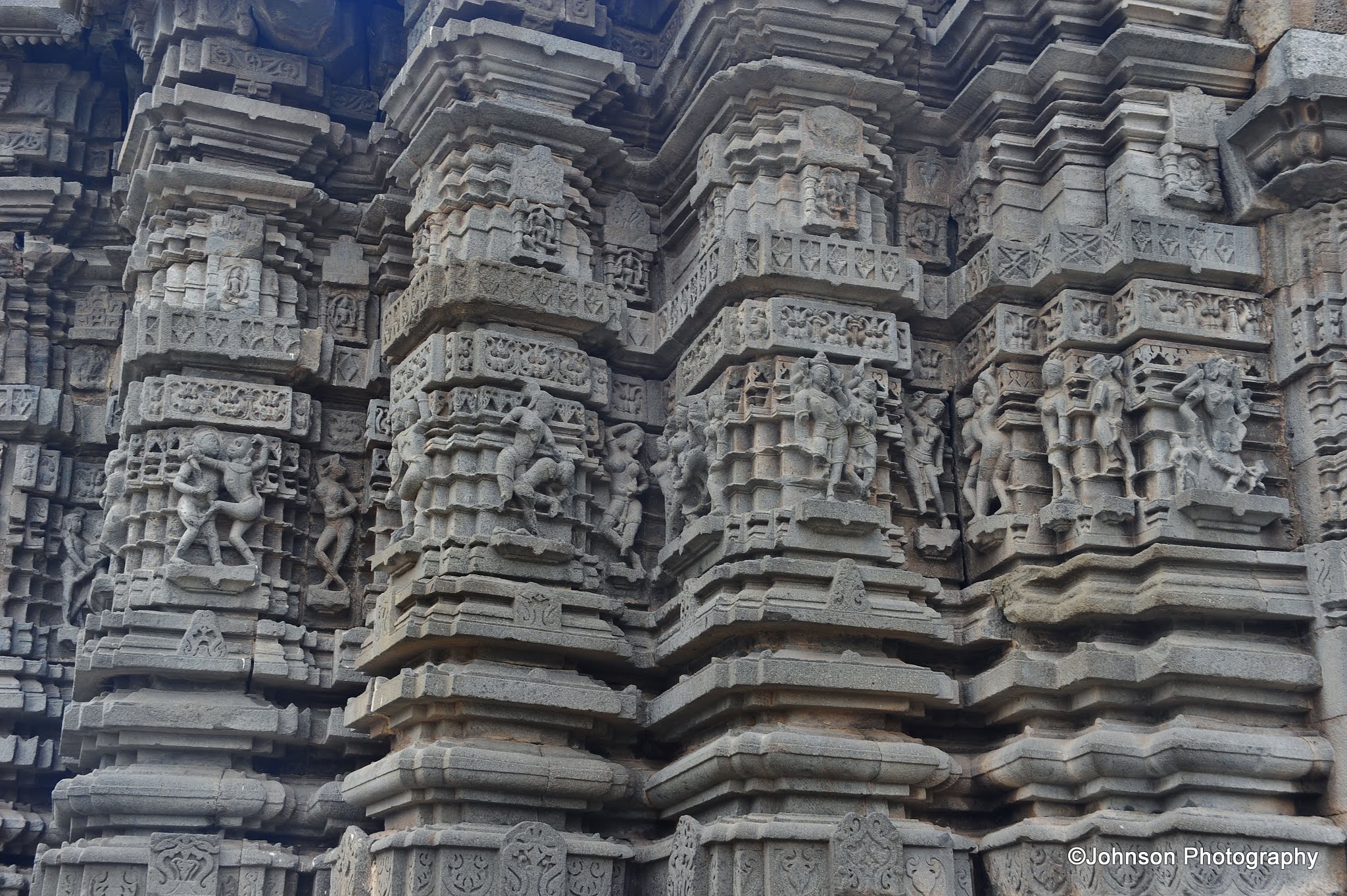
One should not miss the mighty Daitya Sudan Temple with its impressive stone works located at the centre of the Lonar town, a kilometre away from the lake. This is a Vishnu temple dated to the Chalukya Dynasty which ruled central and Southern India between 6th and 12th centuries. It belongs to the Hemadpanthi style of architecture. It features carvings similar to those seen at Khajuraho temples. The diety of this temple is made of an ore with a high metal content that resembles stone. The exterior walls are also covered with carved figures. The plinth of the temple is about 1.5 m in height and the unfinished roof suggests an intended pyramidal for the tower.
The temple receive its name from its connection with the story of the demon Lavanasura or Lonasura who used to dwell in the crater close by and who was eventually slain by Vishnu in his incarnation as Daitya Sudan.
The temple measures 105 feet long by 84 feet wide and is with three chambers. The inner most chamber is garbh gruha, the sanctum sanctorum, where the idol of Lord Vishnu standing atop Lavanasur is present.
Daitya Sudan TempleThe main entrance of the templeThe idol of lord Vishnu standing atop LavanasurArchitectural details of the temple Architectural details of the templeArchitectural details of the templeArchitectural details of the templeArchitectural details of the templeArchitectural details of the temple
How to reach:
Lonar is easily accessible from Mumbai via Jalna. Jalna station lies on the Mumbai-Nanded railway line. There are frequent bus services available from Jalna to Lonar which is about 90km less than 3 hours.
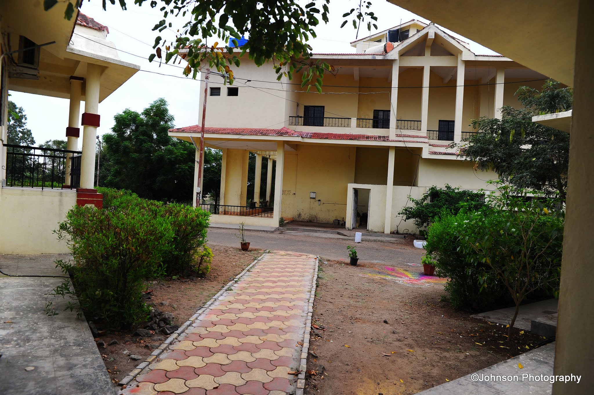
The MTDC guest house is located very close to the crater lake is the best option for accommodation. The guest house also provides one of the best views of the lake.
Rani-ki-Vav is an intricately constructed stepwell situated in the town of Patan in the Indian state of Gujarat. Patan which lays about 130km northwest of Ahmedabad, was an ancient Hindu capital before being sacked by Mahmud of Ghazni in 1024 AD. Rani-ki-Vav is an excellent example of its former glory. This UNESCO World Heritage Site is situated on the banks of Saraswati River. This stepwell is the finest in Gujarat and remarkably well preserved after it was restored in the 1980s. It bagged the title of “Cleanest Iconic Place” in India at the Indian Sanitation Conference in October 2016.
This stepwell was constructed during the rule of the Chalukya dynasty. It is believed that it was built in memory of Bhima I (1022-1064AD) by his widowed queen Udayamati and probably completed by Udayamati and Karna after his death. The stepwell was later flooded by the nearby Saraswati River and silted over until the late 1980s.
Rani-ki-Vav was built in the Maru-Gurjara architectural style. This well measures approximately 64 m long, 20 m wide and 27 m deep. It consists of many pillared pavilions at seven different levels. Minute and exquisite carvings adorn the walls of the well. Most of the sculptures are in devotion to Vishnu depicted in his ten incarnations. It also depicts Nagkanya, Yogini and Apsaras. Apsaras are depicted in 16 different style of make-up to look more attractive which is called Solah-shringar.
Rani-ki-VavDetailed carvingsIntricately carved pillarsDetailed carvingsIntricately carved wallsDetailed carvingsDetailed carvingsDetailed carvings – an incarnation of VishnuAn intricately carved wallDetailed carvingsDetailed carvingsDetailed carvingsDetailed carvingsDetailed carvingsOne of the pillared pavilionsDetailed carvingsIntricately carved wallsPillared pavilionsDetailed carvingsDetailed carvingsDetailed carvingsPillared pavilionsInside one of the pavilionsDetailed carvingsMore detailsMore detailsView of the stepwell from the top
This stepwell was not merely a site for collecting water and socialising, but also hold great spiritual significance. It explicit the ancient concept of the sanctity of water and they considered it as an inverted temple. There are around 800 elaborate sculptures among seven galleries. At the bottom level there is a carving of Vishnu reclines on the thousand-hooded serpent. There is also a small gate below the last step of the step well, with a 30km tunnel (currently blocked by stones and mud), which leads to the town of Sidhpur near Patan. It was used as an escape gateway for the king, in times of defeat.
Rani-ki-Vav is situated in an earthquake prone area and due to this Archaeological Survey of India (ASI) has put it on high alert regarding the risk preparedness and disaster management. Only the top 2 levels of the well are accessible to the visitors and the rest of the areas are out of bound to the visitors.
This much neglected but aesthetically built vav or stepwell is situated in Asarwa area of Ahmedabad city. When it was built in 1500 AD, Asarwa was a village by itself, which has now become an area of the city of Ahmedabad. The stepwell was built by Dhai Harir, a household lady of Sultan Mahmud Begada. She was believed to be the superintendent of the royal harem. Behind the stepwell is the mosque and a tomb built by Dhai Harir, where she was buried.
Built in sandstone this octagonal stepwell is five stories deep. Each floor is built on intricately carved large numbers of pillars and spacious enough for people to congregate. There are air and light vents in the roofs at various floors. From the first storey level, three staircases lead to the bottom level of the well. At the level of the ground, it is 190 feet long by forty feet wide. At the east end, from a domed canopy, a descent of few steps leads to a covered gallery. Built along a east west axis, the entrance is from the east and the two spiral staircases in the west. These spiral staircases are now closed.
The air and light vents in the roofs at various floors and at the landing level are in the form of large openings. From the first story level, three staircases lead to the bottom water level of the well, which is considered a unique feature. The top part of the well is vertical and opened to sky. The carvings of flowers and symbols of Islamic, Hindu and Jain gods are carved at various levels of the well.
The first gallery of the well bears two inscriptions, one in Sanskrit and one in Arabic. As per these inscriptions, the well was constructed in 1500 AD during the reign of Mahmud Shah by Dhai Harir Sultani. The name later corrupted into Dada Hari.
Dada Hari VavThe domed canopy at the east endThe ceiling of the domed canopySteps towards the galleryInterior view of the stepwellThe bottom of the well – there is no waterView from the bottomArchitectural detailsArchitectural detailsArchitectural detailsInscriptions in Arabic from the first galleryInscriptions in Sanskrit from the first galleryView from top
Behind the stepwell is the 16th century mosque built on a platform. The mosque is a 5 domed structure with 2 minarets (which collapsed long ago). The mausoleum contains the tomb of Dhai Harir Sultani. The tomb is beautiful structure with stone carved lattice windows.
The mosque behind the stepwellThe qibla inside the mosqueMosque – architectural detailsMosque – architectural detailsThe mausoleum of Dhai Harir SultaniThe door to the tombMausoleum – architectural detailsOne of the lattice windows of the mausoleum
Mata Bhavani’s well
This is another stepwell which is located about 200m north of Dada Hari’s. This well is several hundred years older and is used as a Hindu temple now.
Inside Mata Bhavani’s stepwellInside Mata Bhavani’s stepwellInside Mata Bhavani’s stepwellInside Mata Bhavani’s stepwell
This remarkably elegant temple is created out of white marble. It was built in 1848 AD at an estimated cost of 8 lakh rupees, a major sum at that period. The construction of the temple was initiated by Shet Hutheesing Kesarising, a wealthy Ahmedabad trader. The construction was supervised and completed by his wife Shethani Harkunvar after the untimely death of her husband. The temple is dedicated to Dharmanatha, the fifteenth Jain Tirthankara. The temple was built during a severe famine in Gujarat. By employing hundreds of skilled artisans the construction supported them for a period of two years during this famine.
The Hutheesing Jain temple is spread over a sprawling courtyard, a mandapa surrounded by a large ridged dome, which is supported by 12 ornate pillars. The main shrine on the east end reaches up into three stunningly carved spires and is encircled by 52 smaller shrines dedicated to the various Tirthankaras. The front is exquisitely ornamented by a dome shaped structure. The architect of the temple was Premchand Salat.
The pictures below are from the exterior of the temple. Photography inside the temple is prohibited.
Hutheesing Jain TempleDetails of the carvingsDetails of the carvingsDetails of the carvingsDetails of the carvingsDetails of the carvingsDetails of the carvingsDetails of the carvingsDetails of the carvingsDetails of the carvingsDetails of the carvingsDetails of the carvingsDetails of the carvingsDetails of the carvingsDetails of the carvings
The outer courtyard of the temple is flanked by a recently built 78 feet Mahavir stambha (tower) fashioned after the renowned tower of Chittor in Rajasthan.
The Mahavir stambha (tower) inside the temple courtyardAnother view of the towerTower detailsThe door of the tower
Built in 1822 AD, this is the first temple of the Swaminarayan sect and the headquarters of the NarNarayan Dev Gadi. The land for construction of this temple was given by the British Imperial Government in India to Swaminarayan. Sir Dunlop, the British officer was so impressed with the activities of Swaminarayan and his followers, that on behalf of the government he gave 5,000 acres of land in Kalupur area of Ahmedabad to build this temple. When the temple was completed, the officer was so amazed by the temple that he commanded a 101 gun salute to the temple. When the British government wanted to build a railway station in Kalupur, the temple returned part of the land, where Kalupur Railway Station stands today.
The temple was mainly constructed in Burma teak wood with opulent carvings of Hindu gods and goddesses in bright shades. The architecture of the central gateway is a mix of regional and British styles. Marathi and Rajasthani folk cultures and costumes are evident on the gateway sculptors.
The NarNarayan temple is the heart of the temple complex and was constructed with intricate carvings in pure Burma-teak, depicting deities and episodes representing Indian tradition and culture. The images in the temple are of Naranarayan Dev in the centre, Radhakrishna Dev on the right, Dharmadev, Bhakti Mata and Harikrishna on the left of the central hall.
The haveli to the west of the temple used to be the official residence of Acharya of the Naranarayan Dev Gadi. Now the ground floor of the front side houses the offices and inner portion accommodates the residence of the ladies who have devoted their life to the temple. The haveli on the north side of the temple was constructed by Acharya Maharjshree Keshavprasadji Maharaj in 1871. This haveli made in wood consists of intricately carved wooden pillars and balconies. An extensive central hall has been constructed on sixty pillars.
The temple attracts a million people the day after Diwali, the festival of lights, celebrated every year in autumn.
Swaminarayan Temple at KalupurThe main entrance gate of the templeThe intricately carved doorsDoor detailsThe templeOne of the entrances to the templeThe carved archesThe carved archesDetailed carvingsDetailed carvingsAn intricately carved balconyMore of the carvingsMore detailsMore detailsThe grand haveli (traditional, ornately decorated house) in the temple complexOne of the elaborately carved pillarsOne of the elaborately carved pillarsOne of the elaborately carved pillarsMore from the haveliMore details
The Sun Temple of Modhera was built during the reign of Bhima I of Solanki dynasty in 1026-27 AD. It resembles the better known Konark temple in Orissa, which it predates by 200 years. It was similarly designed so that the dawn sun shone on the image of Surya the sun god during the equinoxes.
Built in Solanki style the temple complex has three axially aligned components – the main shrine (garbhagriha) in a hall (gudhamandapa), the outer or assembly hall (sabhamandapa) and the sacred tank (kunda). The sabhamandapa is not in continuation with gudhamandapa but is placed little away as a separate structure. Both the structures are built on paved platform. Their roofs have collapsed a long ago. The platform of plinth is inverted lotus shaped.
The gudhamandapa measures 51×25 feet. It is almost equally divided into gudhamandapa, the hall and gabhagriha the shrine proper. The pradakshinamarga is formed by the passage between the walls of garbhagriha and the outer walls of gudhamandapa. The roof of the passage has stone slabs carved with rosettes.
Garbhagriha, the shrine proper, is square measuring 11 feet from inside. The outer walls of the shrine is highly decorated. The base and walls of the shrine and hall are divided into several stretches with unique carvings. The hall in front of the garbhagriha was roofed by a dome which is supported by eight principal pillars below arranged in an octagon, four pillars in front of shrine proper and two each in recesses of windows and door.
The sabhamandapa or the assembly hall has extensively carved exterior. There are 52 intricately carved pillars representing 52 weeks of the year. The roof was in shape of stepped pyramid, but no longer exists. Inside, the walnut shaped ceiling rises in tiers which has numerous floral girdles. It is 23 feet high and supported by pillars arranged in an octagon. Toranas or the decorated arches arise from the lower brackets of the pillars.
The tank in front of the temple is known as suryakunda. The flight of steps through kirti-torana leads to the reservoir. It is rectangular. It measures 176 feet from north to south and 120 feet from east to west. There are four terraces and recessed steps to descend to reach the bottom of the tank. Several miniature shrines and niches in front of the terrace wall have images of gods.
Modhera Sun TempleModhera Sun TempleA closer view of the main temple and the assembly hallCloser view of the main templeDetails of the exterior of the main templeDetails of the exterior of the main templeDetails of the exterior of the main templeDetails of the exterior of the main templeDetails of the pillars insideThe ceiling of the main templeMain temple – pillars and the ceilingIntricate carvings on the pillarsA closer view of the ceiling of the assembly hallWhat you see is some of the intricately carved pillars of the assembly hall. There are total 52 of such pillarsView of the sacred tank from the assembly hallDetails from the assembly hallDetails from the assembly hallMore details of the carvingsMore details of the carvingsMore details of the carvingsMore details of the carvingsMore details of the carvingsThe view of the temple complex – the sacred tank and in the back drop is the assembly hall. The main temple is not visible as it is behind the assembly hallTwo pillars standing alone near the templeView of the sculptured steps of the tank with various small shrinesDetails of the shrines around the sacred tankDetails of the shrines around the sacred tankThe assembly hall reflected in the sacred tank
The waning of the Solanki dynasty and the decline in Sun worship and the vagaries of the Islamic inconoclasts and devastating earthquakes led to the decline of the Modhera Sun temple. This masterpiece of Solanki architecture was plundered and defaced by the armies of Allauddin Khilji. The marauding soldiers placed gun powder inside the sanctum and set fire to it, creating an explosion that caused the main shikhara to collapse. In spite of all this and its magnificent dome missing, the Modhera Sun temple still remains as an architectural wonder, which can amaze any visitor.
The temple is located at Modhera village of Mehasana district in the Indian state of Gujarat.
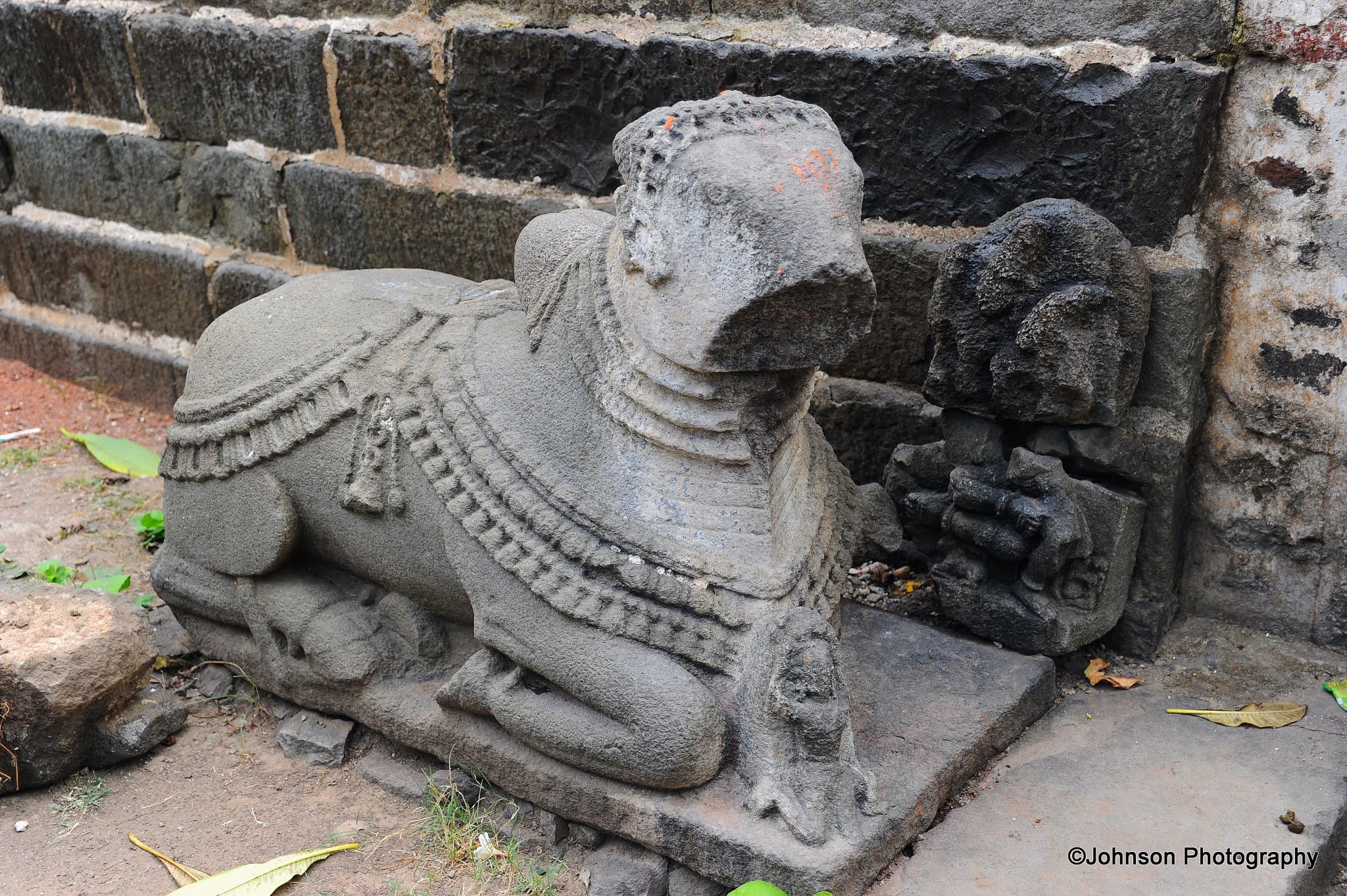
Warangal Fort is situated in Warangal in the Indian state of Telangana. It existed since 12th century when it was the capital of the Kakatiya dynasty. Most of the fort is in ruins and you can see the ancient fort walls scattered around the area. Warangal fort is spread over a radius of 19 km between Warangal and Hanamakonda. It was constructed during the reign of King Ganapti Deva and his daughter Rudramma Devi who ruled until 1289 AD and then under her grandson Prataparudra II, whose reign came to be known as the ‘Golden Age’ of Kakatiya dynasty.
The fort has four ornamental gates or arches, known as ‘Kakatiya Kala Thoranam’, that originally formed the entrances to the now ruined great Shiva temple. This Kakatiyan arch has been adopted and officially incorporated into the Emblem of Telangana state after the state formation in 2014. The temple inside the fort was dedicated to the Mother Earth, Swayambhudevi.
In 1323, Muhammad bin Tughluq marched to Warangal with 65,000 mounted soldiers carrying archery, attacked the fort and plundered and destroyed the city. In keeping with tradition, he ordered the destruction of the Swayambhu Shiva temple where the state deity has been deified. All that is now visible of the temple are remnants scattered around the fort. There are many ruins of wall slabs, brackets and ceiling panels, which are exhibited in the outdoor museum.
Warangal Fort – one of the ornamental gates or arches, known as ‘Kakatiya Kala Thoranam’Warangal Fort – ‘Kakatiya Kala Thoranam’, the detailsWarangal Fort – one of the ornamental gates or arches, known as ‘Kakatiya Kala Thoranam’Relics from the fortRelics from the fort – you can see the minute details of the dress and ornamentsRelics from the fort – a pillarRelics from the fort – a monolithic Nandi statueRelics from the fort – some of the wall panelsRelics from the fortRelics from the fort
Relics from the fortRelics from the fortRelics from the fortRelics from the fortRelics from the fortRelics from the fortRelics from the fortRelics from the fortRelics from the fort
Relics from the fortRelics from the fort – this part of the ceilingRelics from the fortRelics from the fortRelics from the fort – part of the ceilingRelics from the fortRelics from the fort
Within 150 meters of the archaeological zone is the Kush Mahal, which is a public hall built in the 14th century by the Delhi Sultans, who had captured the fort. The mahal which is rectangular in shape is built with huge sloping walls, sliced by six arched openings on each of its sides. There are approach steps on the northeast corner that provides access to the top of the structure, which has scenic views of the entire fort complex. Unfortunately, I didn’t take a picture of Kush Mahal (or may be it got deleted by mistake) but I have the pictures of the exhibits and also views from the top of Kush Mahal.
One of the relics exhibited in the gallery of Kush MahalOne of the relics exhibited in the gallery of Kush MahalOne of the relics exhibited in the gallery of Kush MahalOne of the relics exhibited in the gallery of Kush MahalView from top of Kush MahalView from top of Kush Mahal
Within the southern quarter of the archaeological zone is a big water tank. Inside this tank is a distinctive natural rock formation that protrudes above the water surface. This is called locally as Ourugallu (Single Rock) in Telugu, giving the name Warangal to the fort. A small temple is built over this rock. From the top of the rock one can get the panoramic view of the surrounding area.
The natural rock formation that protrudes above the water surface – There are stairs cut out to reach to the summitThe temple at the tope of the rock formationThe view from the top of the rockThe view from the top of the rockThe view from the top of the rockThe view from the top of the rock
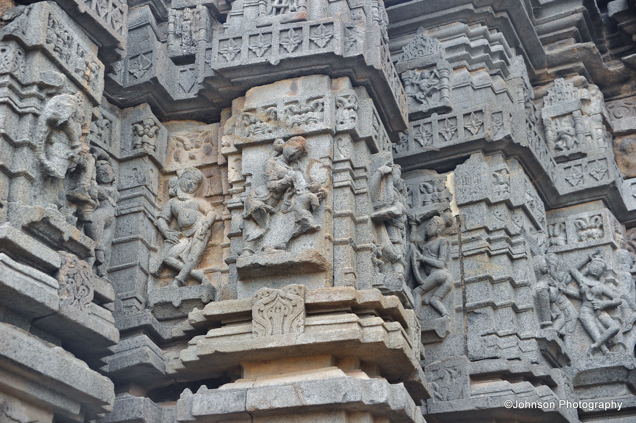
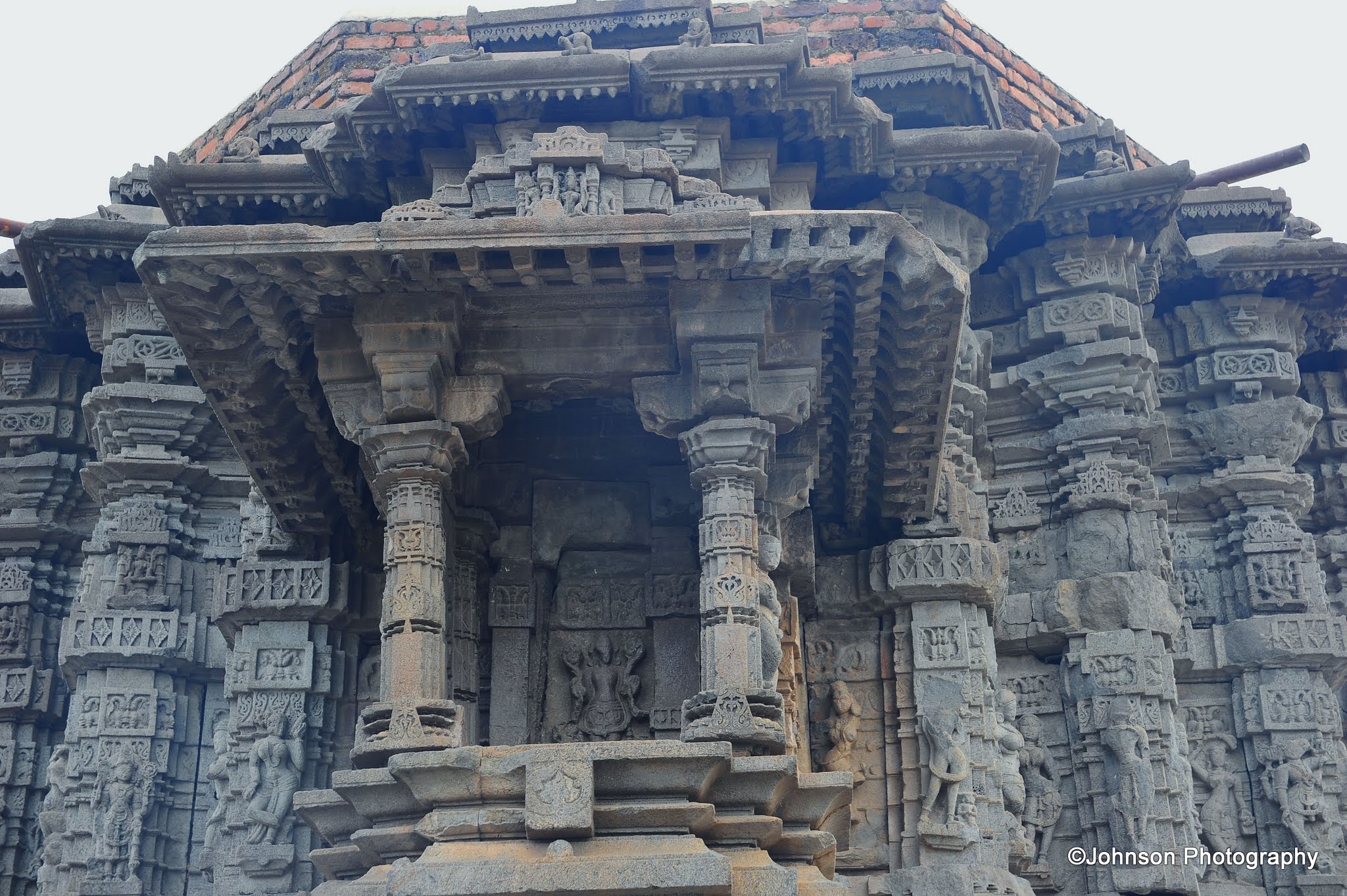
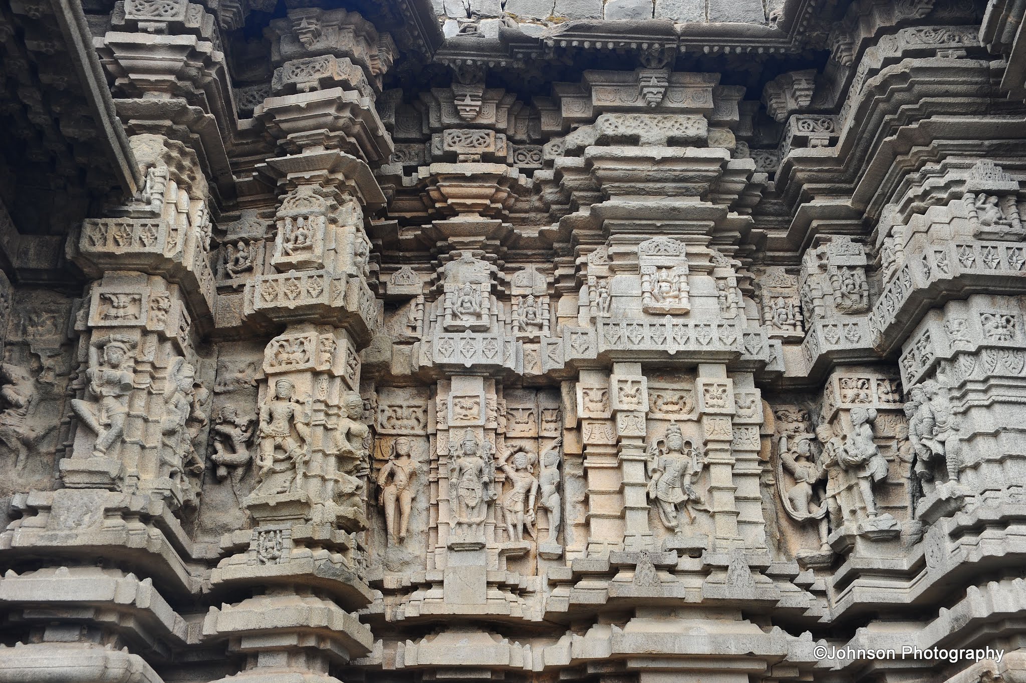
Ramappa Temple also known as the Ramalingeswara temple is located in Palampet village 77 km from Warangal in the Indian state of Telangana. The temple is a marvelous example of Kakatiyan creative genius, with beautiful art, intricate carvings adorning the walls, pillars and ceilings. The roof of the temple is built with bricks, which are so light that they are able to float in water.
According to inscriptions the temple was built in 1213 AD by Recherla Rudra, an army general of Kakatiya ruler Ganapati Deva. The temple is known by the name of the architect Ramappa, who built it. It took 40 years to build this temple. Lord Shiva is worshiped in this temple as Ramalingeswara. The hall in front of the sanctum has numerous carved pillars that have been positioned to create an effect that combines light and space. The temple had remained intact even after repeated wars and natural disasters. There was a major earthquake during the 17th century which caused some damages to the temple.
The temple stands on a raised platform with lateral porched entrances on three sides. The main entrance faces east. The sanctum contains a black basalt linga installed on a high pedestal. Over the ceiling of the main hall is depicted the scenes from Ramayana, Siva Purana and other mythological narratives. The striking peculiarity of the building lies in the arrangement of bracket figures, above the kakashasana level decorated with slender graceful madanikas, Naginis etc. in different poses.
There are two small Shiva shrines on either side of the main temple. One of them has an enormous Nandi within, facing the shrine of Shiva which is in very good condition.
Ramappa TempleRamappa Temple – A closer viewRemappa Temple – DetailsRemappa Temple – DetailsRemappa Temple – Around the templeA stone inscription in the temple groundsThe Nandi statue facing the templeDetailed carvings on the outer wallsThe entranceThese exquisitely carved female forms of Madanikas, Nagins etc. are considered to be the marvels of Kakatiya architectureMore CarvingsAnother detail of the templeThe detailed carvings on the outer wallsMore of the Madanikas, Nagins etc.More of the Madanikas, Nagins etc.More architectural details of the templeMore architectural details of the templeThe detailed carvings on the outer wallsThe detailed carvings on the outer wallsThe detailed carvings on the outer wallsMore architectural details of the templeThe detailed carvings on the outer wallsThe detailed carvings on the outer wallsThe detailed carvings on the outer wallsMore of the Madanikas, Nagins etc.More of the Madanikas, Nagins etc.The main hall of the temple with exquisitely carved pillarsOne of the pillarsDetails of one of the ceilingsDetails of a carved pillarDetails of one of the ceilingsThe door to the sanctum
About a kilometer away from the temple is a lake known as ‘Ramappa Cheruvu’. The lake was constructed in the 13th century and is a magnificent example of irrigation work of Kakatiya Rulers. It is spread over an area of more than 82 square kms with lush greenery all around. The lake is overlooked by beautiful hills in the background providing spectacular views.
The lake near the temple – ‘Ramappa Cheruvu’The lake near the temple – ‘Ramappa Cheruvu’The lake near the temple – ‘Ramappa Cheruvu’The lush greenery around the lake
How to Reach:
From Warangal and Hanamakonda, there are frequent bus services to Mulugu which is at a distance of 50 km. From Mulugu there are frequent buses available to Palampet which is at a distance of around 20 km. The temple is around 500 meters from here.
Shravanabelagola is a city located near Channarayaptna of Hassan District in the Indian state of Karnataka. The Gomateshvara statue at Shravanabelagola is one of the most important tirthas (pilgrimage destinations) in Jainism. The town is a prominent centre for Jaina art, architecture, religion and culture for over 2,300 years. It is a town of ponds and temples. The name of this holy center is derived from the pond called ‘biligola’ (white pond) between two hills. It is believed that Chandragupta Maurya, the founder of the Maurya Dynasty and the Maurya Empire died here in 298 BC after he became a Jain monk and assumed an ascetic life style.
Shravanabelagola has two hills, Chandragiri and Vindhyagiri. The 58 feet tall monolithic statue of Gomateshvara (it is also referred as “Bahubali” by the Jains) is located on the Vindyagiri Hill. It is considered to be the world’s largest monolithic stone statue. The statue is carved beautifully from a single block of rock with accurate sense of proportion and expression. Gomata has curly really nice hair in ringlets on the head and long, large ears. His eyes are open as if viewing the world with detachment. The facial features are perfectly chiseled with a faint touch of smile at the corner of his lips and embody calm vitality. There is an anthill in the background which signifies his incessant penance and from where emerges a snake and creepers which twine around both his legs and his arms culminating as cluster of flowers and berries at the upper portion of the arms. The posture of meditation, of the digambara (nude) statue is known as ‘Kayotsarga’, symbolizing renunciation, self-control and subjugation of ego as the first step towards salvation. It represents the complete victory over earthly desires and needs that hamper spirtual ascent towards divinity.
The statue at Shravanabelagola was voted by the readers of “Times of India” a leading daily, as the first of the Seven Wonders of India by scoring 49% votes.
The base of the statue has an inscription in Prakrit, dating to 981 AD. The inscription praises the king who funded the effort and his general, Chavundaraya who erected the statue for his mother. Every twelve years, thousands of devotees congregate here to perform the Mahamastakabhisheka, a spectacular ceremony in which the statue is anointed with water, turmeric, rice flour, sugar cane juice, sandalwood paste, saffron, and gold and silver flowers.
The Vindhyagiri hill is about 470 feet above the ground and is of solid rock. It must be climbed barefoot. Tourists can use the main steps from the town consisting of dual flights of about 660 steps to the top which was cut out in the rock. You may see old people climb these steps however they are steep and it can be a hard climb. In summer the rock can get hot, so you may carry a pair of socks to be worn while climbing the steps. Old people who cannot climb can avail palanquin services. The palanquin bearers carry them on chair.
The 58 feet tall monolithic statue of GomateshvaraThe steep flight of steps towards the Vindhyagiri hillThe view of the ‘White Pond” from top of the Vindyagiri hill and in the backdrops you can see the Chandragiri hillAt the top of Vindyagiri hillAt the top of Vindyagiri hillAt the top of Vindyagiri hillAt the top of Vindyagiri hillAt the top of Vindyagiri hillThe Gomateshvara statue at the top of the Vindyagiri hillThe Gomateshvara statue at the top of the Vindyagiri hillPilgrims offering prayers at the feet of the satueAnother view of the statueAmazing view from top of the Vindyagiri hillAmazing view from top of the Vindyagiri hillAmazing view from top of the Vindyagiri hillAmazing view from top of the Vindyagiri hill
Chandragiri hill is a small hill located just opposite to the Vindhyagiri hill. It is believed that Chandragupta Maurya, the founder of the Maurya dynasty, breathed his last in this hill. Steps have been cut out in this hill and the ascent is similar to that of Vindhyagiri. It is steep and hard to climb. The hill has memorials to numerous monks and shravakas who have meditated here. Chandragiri also has the tomb of Chandragupta Maurya. There are also several monuments of interest scattered around this hill.
The entrance to the Chandragiri hillSteps leading to the summit of Chandragiri hillThe view of the pond from Chandragiri hillVarious shrines at the top of Chandragiri hillVarious shrines at the top of Chandragiri hillBharatha statue at Chandragiri hillVarious shrines at the top of Chandragiri hillVarious shrines at the top of Chandragiri hillVarious shrines at the top of Chandragiri hillVarious shrines at the top of Chandragiri hillVarious shrines at the top of Chandragiri hillVarious shrines at the top of Chandragiri hillOne of the inscriptions on the rock are protected by glassVarious shrines at the top of Chandragiri hillVarious shrines at the top of Chandragiri hillVarious shrines at the top of Chandragiri hillView of Vindyagiri hill from ChandragiriAmazing views of the surrounding areas from Chandragiri hillAmazing views of the surrounding areas from Chandragiri hillAmazing views of the surrounding areas from Chandragiri hill